Notice:
The advice given on this site is based upon individual or quoted experience, yours may differ.
The Officers, Staff and members of this site only provide information based upon the concept that anyone utilizing this information does so at their own risk and holds harmless all contributors to this site.
Just recently we completed a 3 week 400km, (250 miles) BC west coast Gulf Island sailing trip during wonderful weather and fair winds. Longest leg was 27nm from Clam Bay via Portier Pass to Mc. Donald Beach located approx. 5 km up the North arm of the Fraser River.
We used Navionics charts, US and Canada, in combination with a Bad Elf GPS and an I Pod Touch for navigation in addition to paper charts and a Garmin 72 GPS. The system worked well but... the IPod Touch is screen is too small to see clearly.
We're considering purchasing the larger IPad Touch for our next trip. Any suggestions, pro's or cons regarding the IPad Touch?... much appreciated
Henk & Johanna "Floating", a few off your "barnacles". "Someday Lady" '95 C250WB #151 ('03 - 2016) "Sea ya" 30ft Bayliner (04-2018 - 09-2018) "Mariah" '96 C250WB #191 (05-2019 - 15-05-2023) "Lady J" '00 C250WK #499 (05-2021 - 09-2022)
If this is the primary use you might also want to consider a Nexus 7. The old model is about half the price of an iPad Mini and the Navionics app is similar on both of them. The Nexus 7 also has a built in GPS, so you don't need to use the Bad Elf.
<blockquote id="quote"><font size="1" face="Verdana, Arial, Helvetica" id="quote">quote:<hr height="1" noshade id="quote"><i>Originally posted by awetmore</i> <br />If this is the primary use you might also want to consider a Nexus 7. The old model is about half the price of an iPad Mini and the Navionics app is similar on both of them. The Nexus 7 also has a built in GPS, so you don't need to use the Bad Elf.
<hr height="1" noshade id="quote"></font id="quote"></blockquote id="quote">I'm thoroughly enjoying my Nexus 7 right now. I liked how it helped while we were navigating couple of weeks ago.
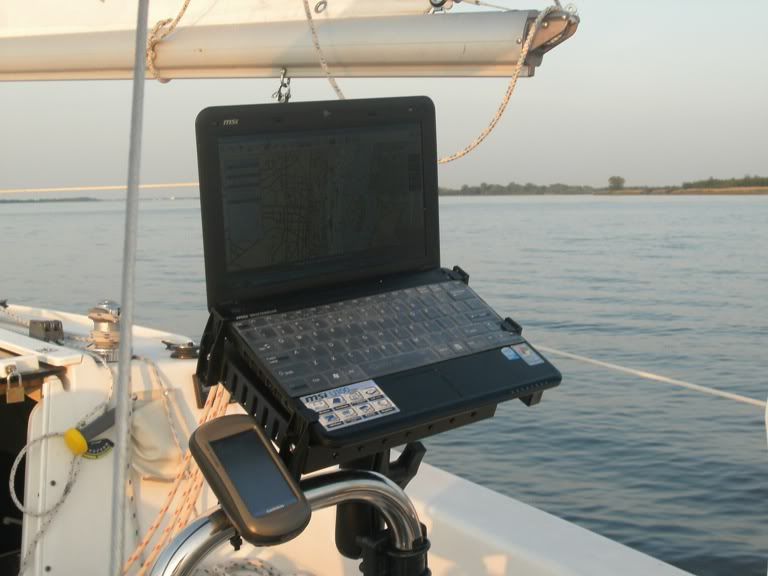
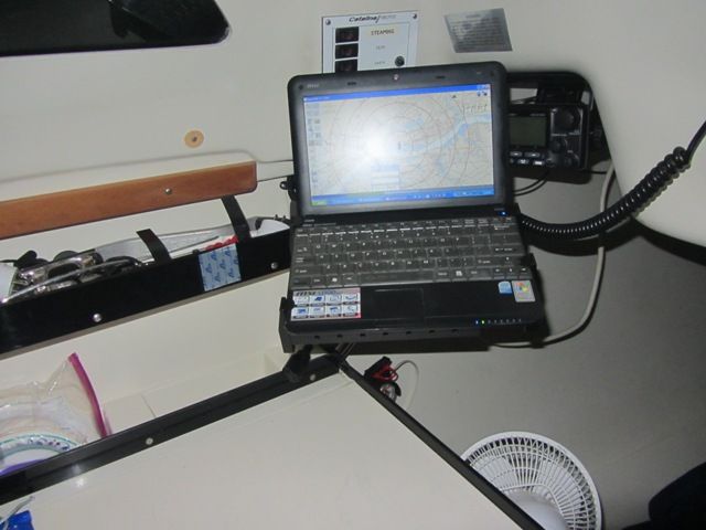
There are many solutions to your issue. My personal favorite is my Netbook, which has a very bright screen. It runs OpenCPN with the free NOAA charts. I've chosen to send GPS and AIS signals to the Netbook via Bluetooth, but you could just as easily tether the Garmin 72 to the Netbook to give GPS coordinates.
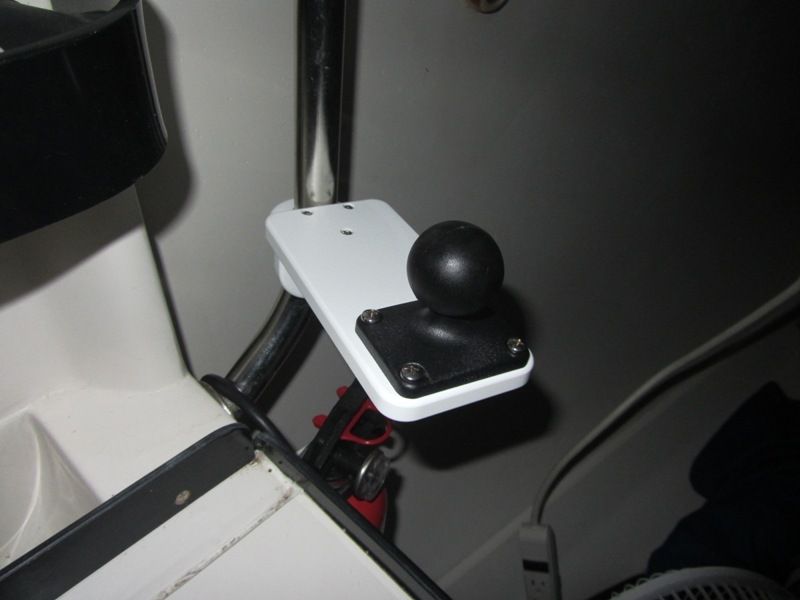
I can't remember if you have a wheel. I have a RAM mount on my binnacle, and also a second mounting point in the cabin for if things get too wet in the cockpit. If it rains, I sit in the companionway at the top of the steps, where I can see the Netbook inside the cabin and steer using a Raymarine wireless remote.
I use my IPad Retina with INavX and am very happy with it. It's slightly better, but has the same issue of reading in direct sunlight as the touch. I have yet to find a screen protector that provides a satisfactory compromise of anti-reflectivity and sharpness. The standard IPad has a lot more screen area and resolution that makes reading charts a pleasure. The internal gps gives the same accuracy as my external receiver. I recommend the 32gig model to all my friends. 16 is just adequate, and the 64 is overkill for most of us. Rumors are that Apple will introduce a high res mini next month, but the pundits are wrong more often than right. Wait and see. 1024 x 768 on a 7" screen is similar to 1500 x 1100 on a 13" laptop, but the Retina display on a regular IPad spoils you very quickly. I would go the extra money for the HD screen of the new Nexus if I were to go in that direction. The App Store is way ahead on available apps optimized for tablets. There are fewer Google Play apps and most are optimized for phones. Having the apps you want is the critical issue.
Notice: The advice given on this site is based upon individual or quoted experience, yours may differ. The Officers, Staff and members of this site only provide information based upon the concept that anyone utilizing this information does so at their own risk and holds harmless all contributors to this site.